Assynt: Suilven, Stac Pollaidh and the strangest landscape
Somewhere around Kylesku, the landscape stops behaving like the rest of Scotland. The hills around Torridon and Wester Ross at least queue up in ranges. In Assynt they don't bother: Suilven, Canisp, Quinag and Stac Pollaidh rise alone out of a boggy, lochan-studded plain like something drawn by a child who'd never seen a real mountain, each one unconnected to its neighbour, each one on some of the oldest rock on Earth. Geologists come here for the Lewisian gneiss, three billion years old and among the most ancient exposed rock anywhere on the planet. Everyone else comes for the fact that nowhere else looks quite like this.
🧭 At a glance
Route: Scourie or Kylesku → Lochinver → Clachtoll → Loch Assynt → on to Ullapool
Time: a full day of driving and short stops, or two nights if the beaches and the mountains both want a piece of your itinerary
Best for: anyone who wants the extraordinary skyline of the north-west Highlands, plus some of its best beaches
Don't rush: the Stoer peninsula detour — it's a dead end, but it's the right kind of dead end
📶 Before you set off. Signal is unreliable through most of Assynt and disappears completely on the Stoer peninsula and around Loch Assynt. On Wi-Fi, open Google Maps, tap your profile icon, choose Offline maps, then Select your own map, and drag the box to cover Kylesku, Lochinver, Clachtoll and Loch Assynt.
1. The road in: Kylesku and the B869
The Kylesku Bridge carries the main A894 in a single elegant concrete curve over the mouth of Loch Glèann Dubh and Loch a' Chàirn Bhàin, and it's worth a stop in its own right before you've even reached Assynt proper. From the north side of the bridge, smaller vehicles can peel off onto the B869, a spectacular but technical single-track road that hugs the coast all the way to Lochinver. Anything bigger should stay on the main road.
⚠️ Route warning. Large motorhomes and nervous drivers should remain on the main A-roads and avoid the B869 coastal detour, which has severe gradients and blind hairpins.
Kylesku Bridge
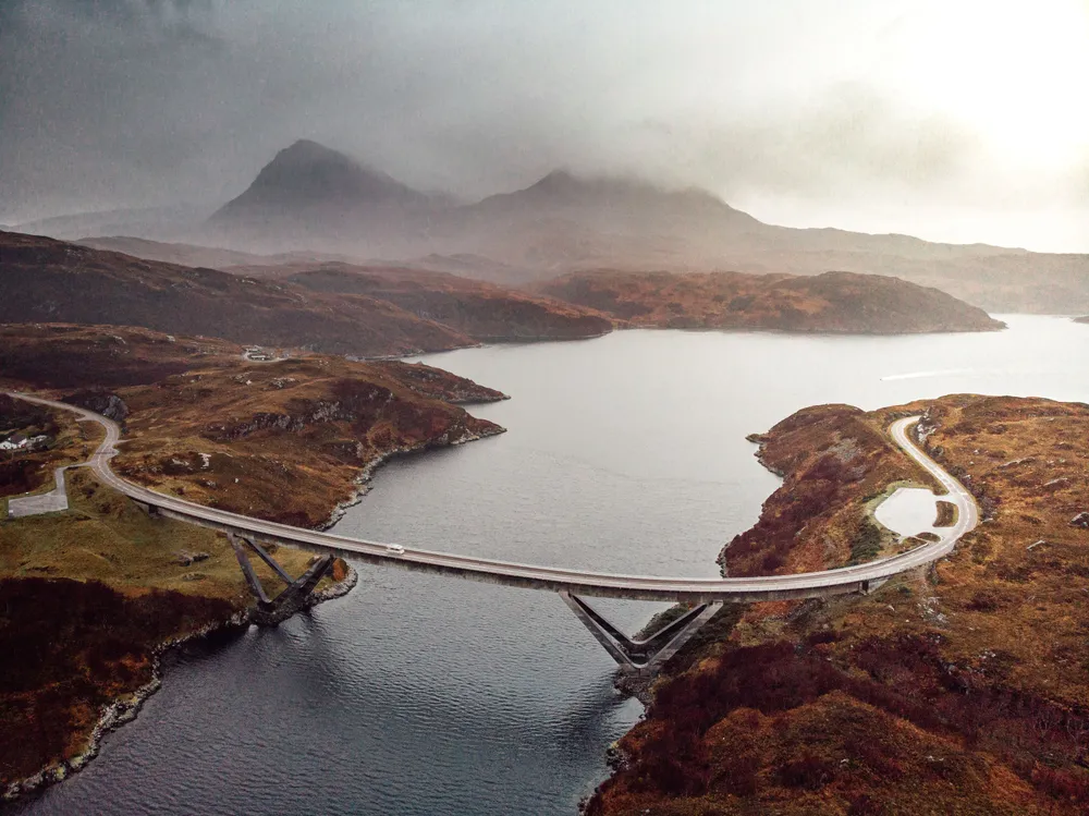
An elegant concrete curve spanning deep water, framed by mountains on every side. The viewpoint car park on the north side gives the classic photograph.
Time needed: 15–20 minutes.
💡 Insider tip. The best photo vantage point is the car park on the north side of the bridge. Watch out for strong crosswinds when opening your car doors.
Undiscovered Scotland: Kylesku · Navigate · Google Maps
Kylesku Hotel
A boutique hotel and restaurant right on the water beside the old ferry slipway, built around hand-dived scallops, crab and langoustines landed within sight of the dining room. A good reason to time your crossing of the bridge for lunch.
Official website · Navigate · Google Maps
2. The Stoer peninsula
If you took the B869, the peninsula north of the road out to Stoer is a detour off a detour — and one worth making time for. It's a dead end, so whatever you find out there, you'll be driving back the way you came.
Stoer Head Lighthouse
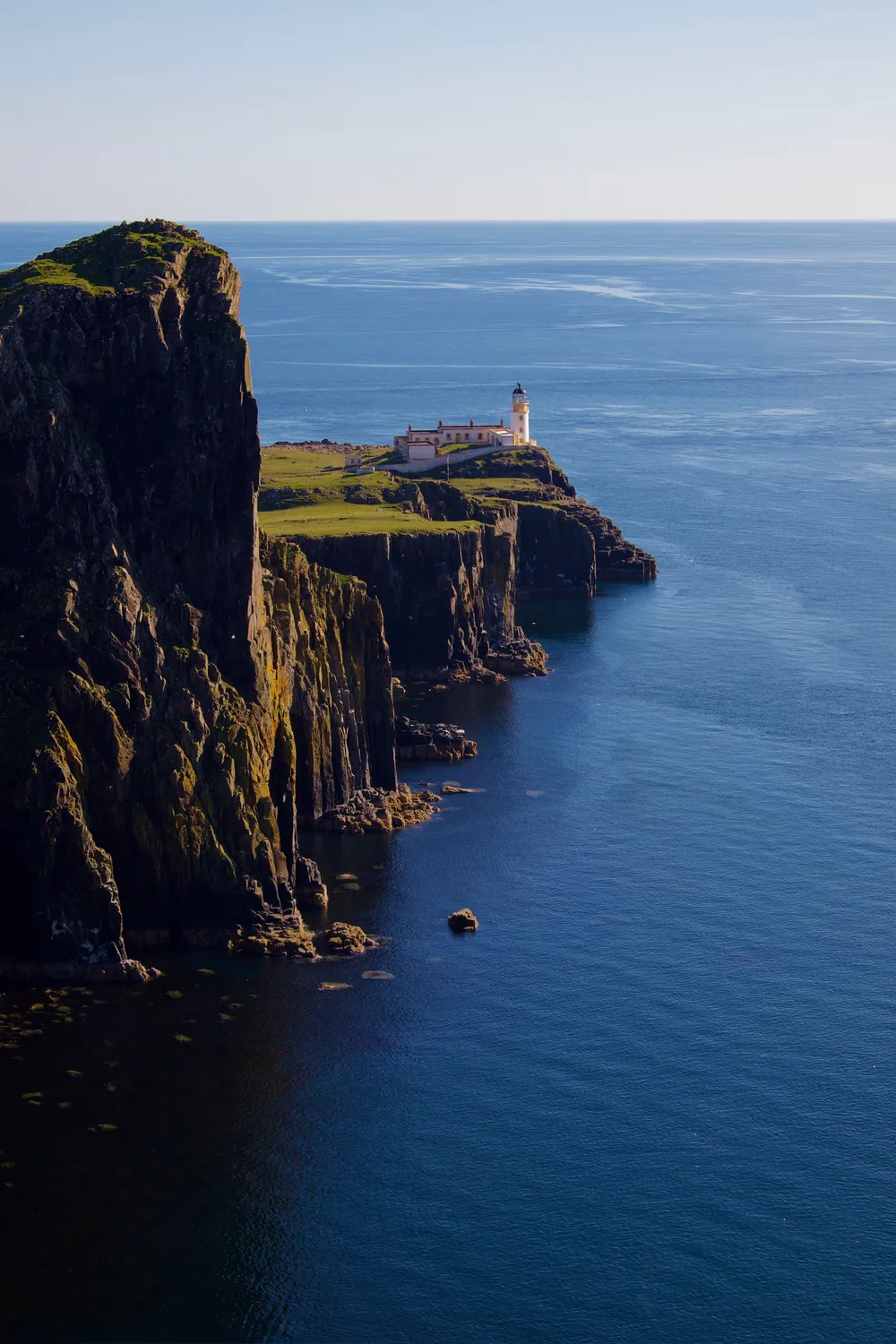
Park at the lighthouse and walk the coastal path for a view of the Old Man of Stoer, a sea stack standing apart from the cliffs like a smaller, wilder cousin of the Old Man of Hoy.
Time needed: 1.5 to 2 hours.
💡 Insider tip. The cliff walk out to the Old Man of Stoer sea stack takes about 45 minutes each way over rough, boggy ground. Wear proper walking boots, not trainers.
Northern Lighthouse Board · Navigate · Google Maps
Achmelvich Beach
Crushed white shell sand and water that turns a startling Caribbean turquoise on a clear day — the kind of beach that looks digitally altered in photographs until you're standing on it. Good for a brisk swim, a paddleboard, or just sitting with a flask wondering how this is still Scotland.
Time needed: about 2 hours.
💡 Insider tip. Look for Hermit's Castle on the rocky headland just north of the beach — a tiny, eccentric concrete folly built in the 1950s and reputed to be Europe's smallest castle. Easy to miss, worth the five-minute detour.
Walkhighlands: Achmelvich Beach · Navigate · Google Maps
3. Lochinver and the strangest skyline in Scotland
Lochinver itself is a working harbour village, small and unpretentious, but it earns its place on this route for what stands behind it. Suilven rises to the east: a long sandstone ridge that reads as one shape from Lochinver and an entirely different one from Elphin, twenty minutes inland, thanks to a summit hidden until you're almost on top of it. Its name is thought to come from Old Norse for "pillar mountain," which the Vikings sailing this coast presumably meant as a compliment. Further round, Stac Pollaidh is smaller at 612 metres but more theatrical, its ridge splintered into pinnacles that look, from a distance, like a row of broken teeth. Neither peak connects to a walking route from Lochinver itself; both are best appreciated as scenery from the road and the beaches, unless a serious hill day is already on your itinerary.
Lochinver Larder
Home of the legendary Lochinver pie — venison and cranberry is the one to order — eaten in, or carried down to the harbour wall with a view of the boats and, on a clear day, Suilven itself.
Official website · Navigate · Google Maps
4. South of Lochinver: Clachtoll
A few minutes south on the B869, Clachtoll is Achmelvich's quieter sibling: another white-shell bay with the same improbable turquoise water, plus a geological party trick of its own.
Clachtoll Beach & Split Rock
Walk out to the headland to find the Split Rock, or A' Chlach Thuill, a huge sandstone slab cleaved cleanly in two by the sea — you can walk between the halves at low tide.
Time needed: about 1 hour.
💡 Insider tip. The restored Clachtoll Broch, a short walk south along the shore, is one of the best-preserved Iron Age brochs on the west coast — worth the extra 20 minutes if archaeology interests you at all.
Walkhighlands: Clachtoll Beach · Navigate · Google Maps
5. Where to stay tonight
Inver Lodge Hotel for Lochinver's luxury option: a hillside position above the harbour, views straight to Suilven, and a fine-dining restaurant to end the day on. Book · hotel website · Navigate · Google Maps
Clachtoll Beach Campsite for a family-run site tucked behind the white-shell beach itself, with modern facilities and a campsite shop for essentials. Book · campsite website · Navigate · Google Maps
6. Onward: Loch Assynt and Ardvreck Castle
Leaving Lochinver on the A837, the road runs alongside Loch Assynt to one of the much-photographed ruins in Assynt.
Ardvreck Castle Ruins
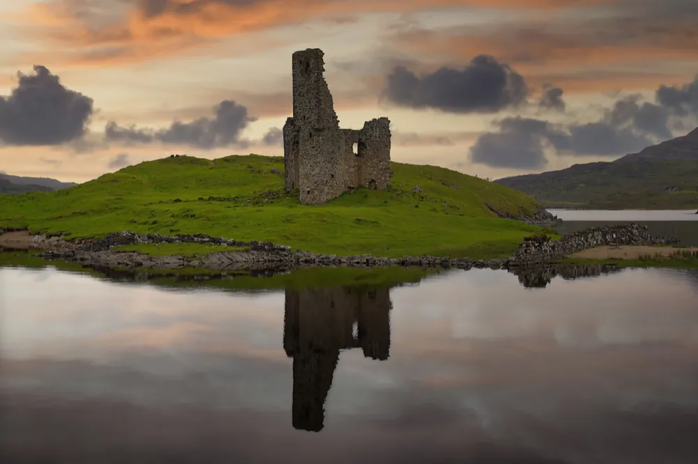
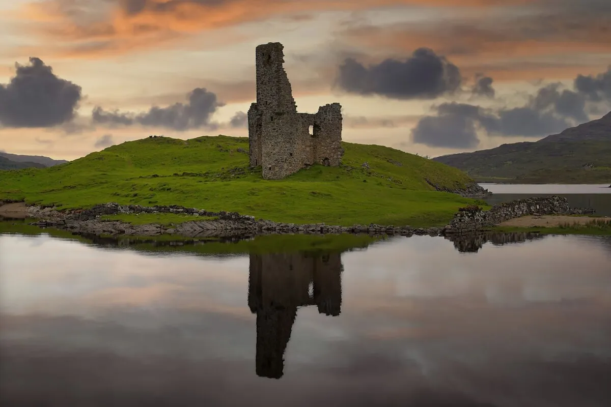
The ruined 16th-century fortress of Clan MacLeod stands on a promontory in the loch, roofless and hauntingly photogenic, with Quinag rising behind it.
Time needed: 30–45 minutes.
💡 Insider tip. Parking here is extremely limited. If the small layby is full, do not block the single-track road; wait patiently or use the overflow a short walk up the road.
Undiscovered Scotland: Ardvreck Castle · Navigate · Google Maps
From here the A837 continues past Knockan Crag, where the road does some serious geological work of its own, before dropping into Ullapool. Read the full feature on Ullapool if that's your next stop.
What to avoid
Taking a motorhome onto the B869. It's stunning and genuinely unsuitable for large vehicles — stay on the A894/A837 if in doubt.
Skipping the Stoer peninsula because it's a dead end. It is, and it's still one of the detours worth making in Assynt.
Blocking the road at Ardvreck Castle. The layby is tiny. Wait for a space rather than parking on the single track.
Assuming signal. Download offline maps before you leave Kylesku or Scourie.
Next step
Heading onward? Read our feature on Ullapool: the harbour town at the hinge of the coast.
Free guide: Short Walks & Water Days. Eleven walks, boat trips and swims, each with the one thing to know before you lace up, in a short PDF for your phone. Get the free Short Walks & Water Days
For the car park at the foot of the hill. The Route500 Scotland Travel Mug is 20 oz of double-wall vacuum insulated stainless steel in Highland Navy, with a slide-lock lid, and it comes with free tracked worldwide shipping. See the Travel Mug
