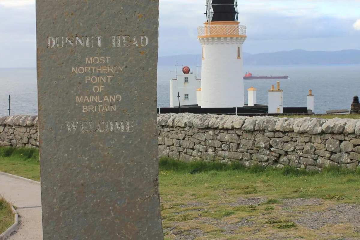
Thurso, Wick and Dunnet Head: the true north
Most people who make it this far assume John o'Groats is the top of Britain. It isn't. That title belongs to a windswept headland a few miles further on, and the difference matters less for the geography than for what it says about Caithness itself: a flat, treeless, endlessly windswept county that keeps its best things slightly off the route everyone else takes. This was Scotland's herring capital in the nineteenth century, when Wick's harbour held hundreds of boats and the town swelled with gutters and coopers chasing the shoals. The boom is long gone, but the harbour, the flagstone and the sheer, birdswept cliffs remain.
🧭 At a glance
Route: Wick → Whaligoe Steps → John o'Groats & Duncansby Head → Dunnet Head → Thurso
Time: a full day of driving and stops, or overnight in Wick or Thurso to split it in two
Best for: anyone who wants to stand on the actual top of mainland Britain, plus a genuinely strange flight of cliffside steps
Don't rush: Duncansby Head — the sea stacks are better than John o'Groats itself
📶 Before you set off. Signal is patchy around Whaligoe and drops out completely on the minor roads out to Duncansby Head and Dunnet Head. On Wi-Fi, open Google Maps, tap your profile icon, choose Offline maps, then Select your own map, and drag the box to cover Wick, John o'Groats, Dunnet Head and Thurso.
1. Wick and the Whaligoe Steps
Wick doesn't try hard to impress you, which is part of its appeal. It was one of the busiest herring ports in Europe at its Victorian peak, and the harbour still carries that scale even with the fleet long gone. A few miles south, off the A99, a discreet lay-by marks the start of something much stranger.
Whaligoe Steps
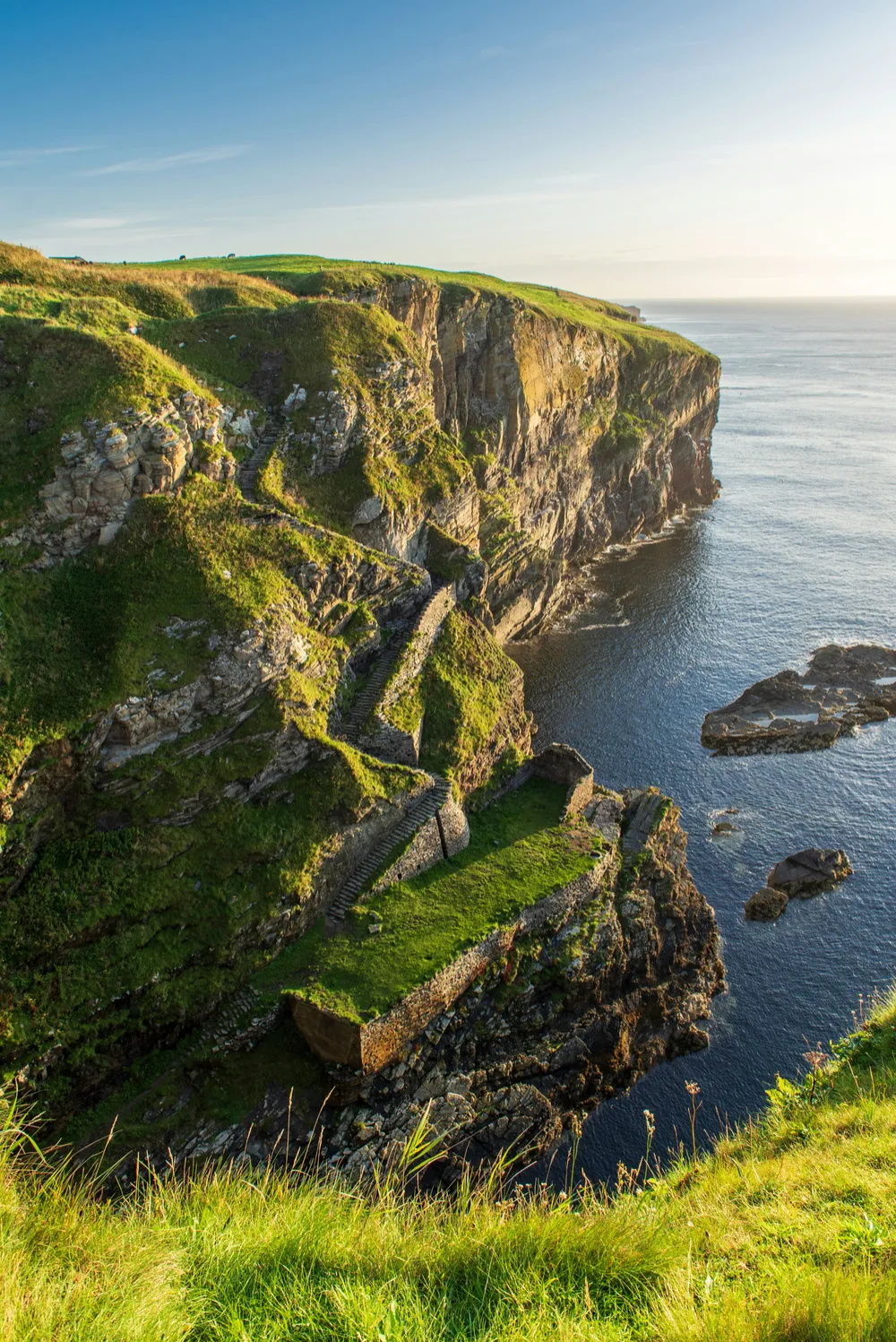
Three hundred and thirty historic flagstone steps, cut directly into a sheer cliff face, descending to a hidden, ruined nineteenth-century herring port at the bottom. Fishwives once carried creels of herring up this same staircase on their backs. Nothing about it is signposted from the road; you simply have to know it's there.
Time needed: 45 minutes.
💡 Insider tip. The steps are steep and can be exceptionally slippery. Avoid descending if it has been raining heavily, and take your time coming back up.
Walkhighlands: Whaligoe Steps · Navigate · Google Maps
2. Onward: John o'Groats and Duncansby Head
The A99 continues north past Wick to John o'Groats itself — famous mostly for being famous, a scatter of gift shops and a signpost pointing at Land's End. The real payoff is two miles further on.
⚠️ Route warning. Watch out for narrow country lanes and sudden farm vehicle traffic when navigating out to Dunnet Head.
Duncansby Head & Sea Stacks
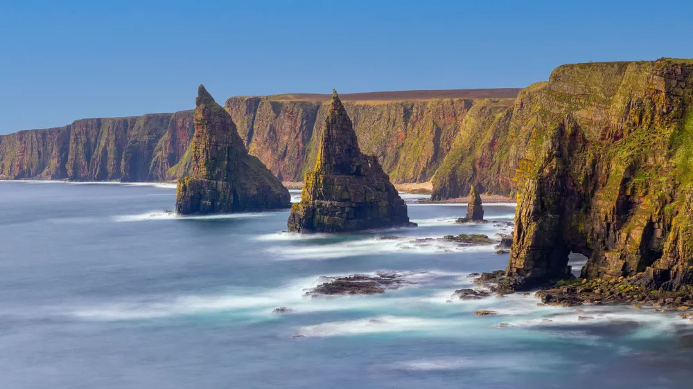
Drive past the John o'Groats signpost to the lighthouse at the very end of the road, then take the short clifftop walk to the Stacks of Duncansby: great sandstone pinnacles rising sheer out of the sea, considerably more dramatic than anything at John o'Groats itself.
Time needed: 45–60 minutes.
💡 Insider tip. The ground near the cliff edge is often boggy even in summer. Wear waterproof hiking boots for the short walk over the hill.
Walkhighlands: Duncansby Head · Navigate · Google Maps
3. Dunnet Head: the actual top of Britain
West along the coast from John o'Groats, a minor single-track road runs out to a headland that gets a fraction of the visitors and holds the title everyone assumes belongs to its more famous neighbour.
Dunnet Head
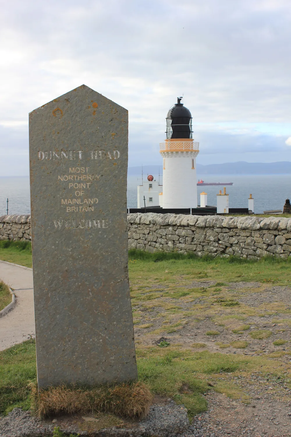
The actual most northerly point of mainland Britain. Stand atop 300-foot cliffs with views across the Pentland Firth to the Orkney Islands, with nothing but a lighthouse and the wind for company.
Time needed: 45 minutes.
💡 Insider tip. Bring binoculars — the cliffs around the lighthouse are a massive nesting colony for puffins, razorbills and fulmars from May to July.
RSPB: Dunnet Head · Navigate · Google Maps
4. Thurso and Scrabster
Thurso is Caithness's main town, workaday and unpretentious, with the ferry port at Scrabster a couple of miles north handling the crossing to Orkney. It's also where the county's best seafood restaurant happens to be.
Captain's Galley Seafood Restaurant, Scrabster
A multi-award-winning seafood restaurant right on Scrabster harbour, cooking whatever the boats landed that morning. Booking is advised, especially in summer.
Official website · Navigate · Google Maps
5. Where to stay tonight
Forss House Hotel, Thurso for a Georgian country house in 20 acres of riverside woodland outside town, with a well-regarded restaurant and a serious whisky bar. Book · hotel website · Navigate · Google Maps
Thurso Bay Caravan and Camping Park for clifftop pitches above Thurso Bay with views across the Pentland Firth to Orkney, ten minutes' walk from the town centre. No advance bookings — pitches are first come, first served, and the gates close at 7pm. Campsite website · Navigate · Google Maps
If you're basing yourself in Wick instead, Mackays Hotel sits on Ebenezer Place — the world's shortest street — with its own bistro, and Wick River Campsite offers a quiet riverside pitch ten minutes' walk from the town's pubs and shops. Mackays Hotel website · Navigate · Google Maps · Wick River Campsite website · Navigate · Google Maps
6. Onward: into the wilds
From Thurso the road turns properly remote: the A836 runs west into Sutherland's empty north coast, past Strathy Point and on towards Tongue and Durness. This is where the landscape begins to feel different at all and starts feeling like somewhere else entirely.
What to avoid
Skipping Whaligoe Steps because it isn't signposted. That's exactly why it stays quiet — look for the small car park off the A99.
Stopping at John o'Groats and turning back. Duncansby Head, two miles further on, is the better view by some distance.
Assuming John o'Groats is the top of Britain. Dunnet Head, to the west, actually holds that title.
Assuming signal. Download offline maps before you leave Wick or Thurso.
Next step
Heading onward? Read our feature on Durness and Smoo Cave: the far north-west corner.
Free guide: Heritage Stops Guide. Eleven heritage stops, from castles to an Iron Age broch, in a short PDF for your phone. Get the free Heritage Stops Guide
For the cliff top. The Route500 Scotland Travel Mug is 20 oz of double-wall vacuum insulated stainless steel in Highland Navy, with a slide-lock lid, and it comes with free tracked worldwide shipping. See the Travel Mug
